About
What we'll do
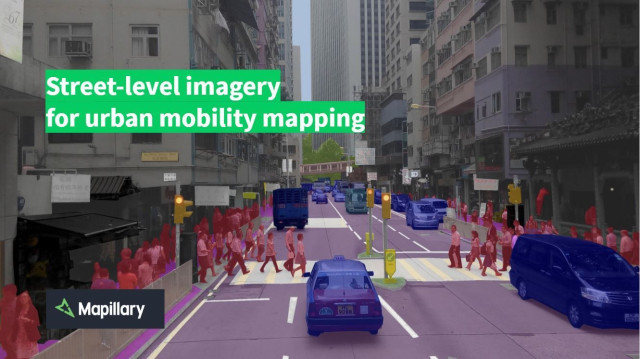
This event is a follow up to Maptime Melbourne’s last event with AURIN in December. We will be taking a hands-on look at street-level imagery and the way in which it can assist mobility focused mapping. To do this, we’ll be taking a walk around the block and using Mapillary to capture images. We’ll then come back and upload the images while editing mobility specific map features such as kerb cuts and crosswalks in OpenStreetMap. We'll be using Mapillary's computer vision detections to aid us in this process.
You do not need any prior mapping experience for this event. All are welcome.
Agenda
18:00 - 18:15 Introductions and photo mapping walkthrough
18:15 - 18:30 Photo mapping
18:30 - 18:40 Uploading
18:30 - 18:45 Mobility mapping examples
18:45 - 19:45 Mapathon
19:45 - 20:00 Wrap up
What to bring
- Laptop - Computers are not provided to bring your laptop to get the most out of this workshop.
- Mouse - It will be a lot easier to make precise map edits with a mouse.
- Smartphone with Mapillary app installed - Download the Mapillary app before the event on iOS or Android and create an account. Clear some space on your phone so that you have enough room to store imagery.
Directions
The best approach is to enter Alan Gilbert from Barry St and walk up the stairs to Level 1 that appear directly in front of you. At the top of the stairs, follow the sign-posted entrance to Theatre 4 and room 123 is just past the theatre entrance. There is also lift access available to level one.
Arrive before 18:00 to avoid getting locked out. If you arrive after this time, call[masked] to be let in.
Comments

Using computer vision for urban mobility mapping - AURIN Maptime Event